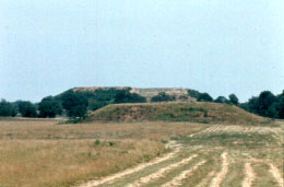
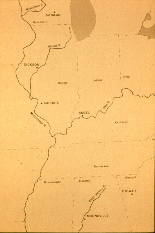
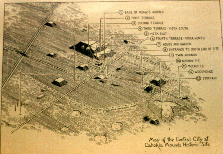
The Mississippian Cultures

Map of the Mississippian cultural area.


At left is a drawing of "downtown" Cahokia, an area of 5.1 square miles (13.2 km). This area was the geographical and population center of a large system of Middle Mississippian sites within the American bottom region. The date of the site reconstructed here is around A.D. 1250, at the end of the Moorhead phase (1150 1250). Missing in this representation are the very numerous houses in which nearly all of Cahokia's estimated population of around 25,000 people lived. (Map courtesy of Cahokia Mounds State Historic Site.)


Monk's Mound in the background at right, and Mound 42 in front of it. Monk's Mound is the third largest pre-Columbian structure in the New World (Teotihuacan and the pyramid at Cholula are larger.) It measures 1,000 feet from north to south, over 700 feet from east to west, and covers about 15 acres. It was built in successive stages between A.D. 900 and 1250.


At left is Model of Monk's Mound. Built on the remains of a Woodland village, Monk's Mound was enlarged at least 13 times in 350 years. On the fourth terrace at the top of the mound (No. 1 on the model) were the possible remains of a building measuring 100 by 48 feet.
The southwest comer of the first terrace (No. 2) was an area of intense building activity lasting from about 1100 to 1300. Houses with thatched roofs and upright wall posts stood where the platform mound was later built in nine stages. On the platform mound were erected posts which were important to an alignment with Mound 72. Most of the surface of this terrace and mound was disturbed by the farming activities of Trappists monks (for whom the mound is named) in the early 19th century.


Terrace on West side of Monk's Mound, probably the last addition to the mound.


Monk's Mound, south side. Facing the former plaza on the south side of Monk's Mound is evidence of a ramp leading to the first terrace. Traces of log steps, which have been reconstructed, were found here. At the top of the steps were remains of a wooden fence running in an east west direction, which may have barred entrance to the building on the top of the mound.


Forward to the next page of this essay

Back to the previous page

Back to Online Essays


   Department of Anthropology
   copyright © 2002 University of Illinois, All rights reserved.
Questions and Comments to Brenda Farnell